FME Flow
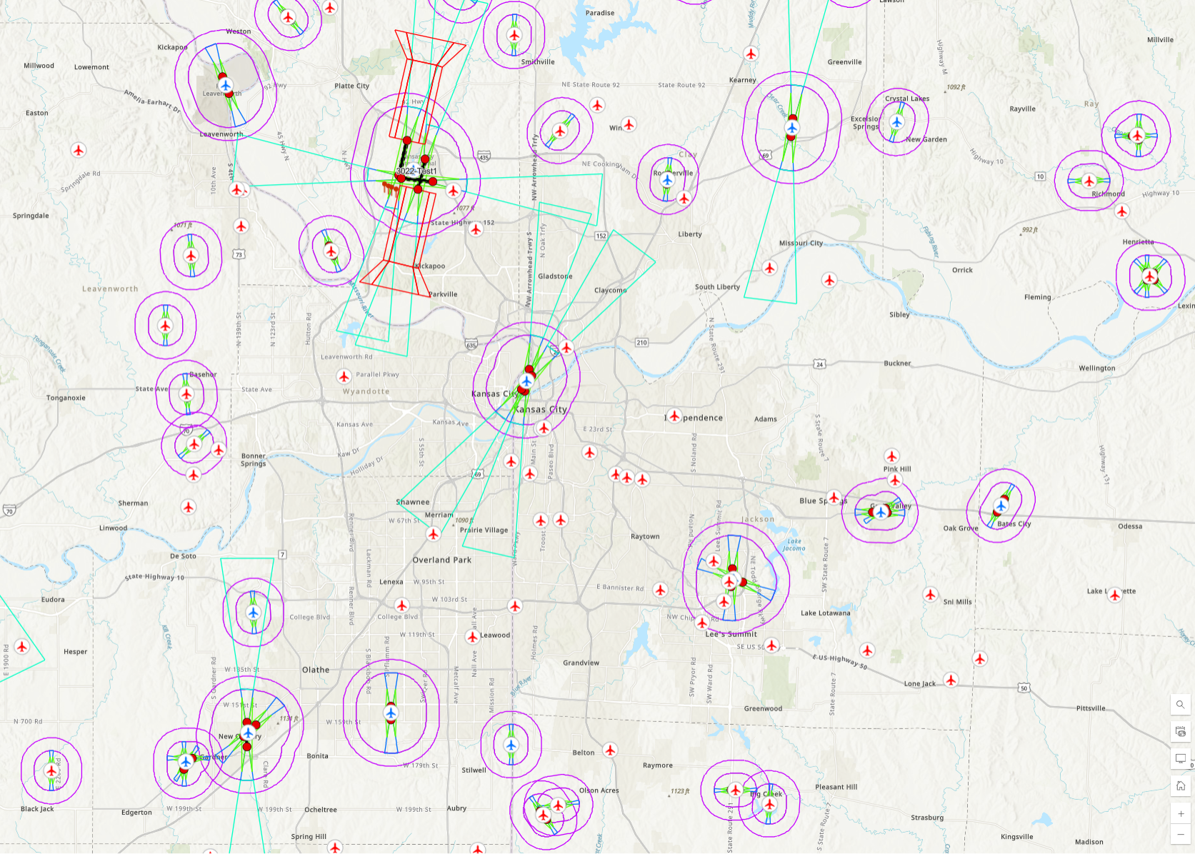
FAA Airspace Modeling
Utilizing data from the FAA, airspace protection surfaces are modeled and made available to project teams.
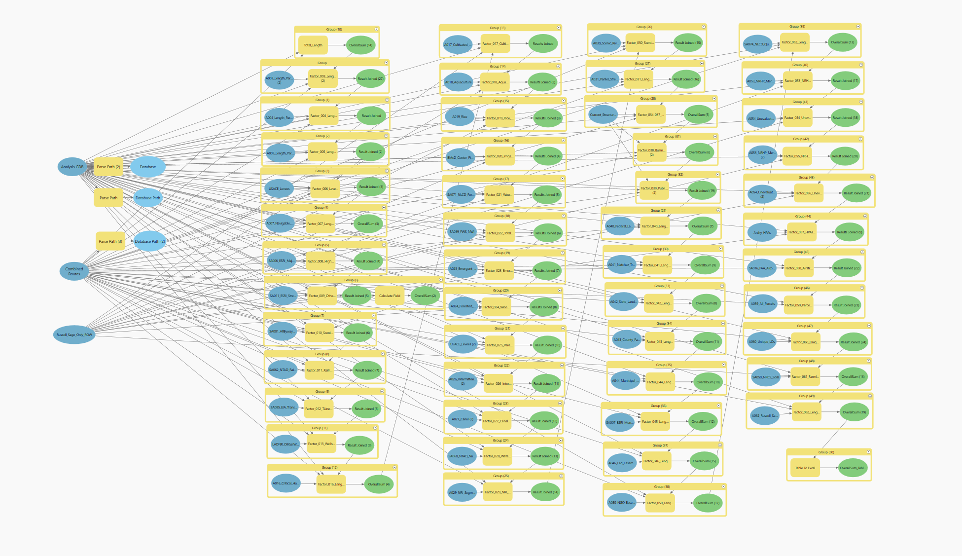
Revolutionizing Geospatial Management: Streamlining Processes, Enhancing Quality, and Saving Thousands of Hours Annually.
The implementation of the Geospatial Governance Program under my leadership has been a transformative initiative for our organization, estimated to save our GIS staff approximately 6,000 hours this year. This comprehensive program was meticulously designed to enhance the efficiency and effectiveness of our geospatial endeavors through the integration of several key components.
Firstly, the program introduced multiple levels of quality checks, a move that significantly elevated the accuracy and reliability of our geospatial data. These checks ensure that every piece of data, regardless of its source, undergoes rigorous validation before being utilized in our projects. This step is crucial for maintaining the integrity of our analyses and the trust of our clients and stakeholders.
Additionally, the development of standard schemas has been instrumental in creating a unified language for our geospatial data. By standardizing the structure and format of our data, we’ve streamlined the integration process across various projects and platforms, facilitating smoother transitions and collaboration among teams. This uniformity is especially beneficial when dealing with complex datasets and intricate analytical tasks, allowing for a more seamless and efficient workflow.
Another cornerstone of the program is the establishment of standardized data repositories. These repositories serve as a central hub for storing and accessing geospatial data, ensuring that all project teams have access to the same, up-to-date information. This system is invaluable when project staff are unavailable, and substitutes are needed, as it allows new team members to quickly familiarize themselves with the project’s geospatial components without the need for extensive handovers or the risk of data silos.
The governance program has also emphasized the importance of training, with approximately 1,300 person-hours dedicated to ensuring our team’s proficiency in the latest geospatial technologies and methodologies. This investment in our staff’s skills has paid dividends in enhancing our operational capabilities and enabling us to leverage geospatial technology more effectively across our projects.
In summary, the Geospatial Governance Program has set a new benchmark for geospatial practice within our organization. By fostering a culture of excellence in data management, standardization, and staff development, we’ve not only streamlined our internal processes but also positioned ourselves to deliver superior value to our clients. This initiative reflects our commitment to leveraging technology to achieve greater efficiency, accuracy, and project success.
Utilizing data from the FAA, airspace protection surfaces are modeled and made available to project teams.