FAA Airspace Modeling
Part 77 Surfaces
FME Flow

FAA Airspace Modeling

Utilizing data from the FAA, airspace protection surfaces are modeled and made available to project teams.

  • Role: Application Developer
Summary:
  • Developed an Aeronautical Modeling Application: Developed a tool with FME Flow for automated updates of FAA Part 77 airspace surfaces, enabling precise project planning with the latest data.
  • Enhanced 3D Modeling Capabilities: Added functionality to model TERPS and Part 77 surfaces in 3D, facilitating accurate structure height calculations.</font></li>
  • FAA Obstruction Compliance Support: The tool helps avoid FAA obstruction issues, reducing the need for structure marking and lighting.</font></li>
  • Leveraged Advanced Surveying Techniques: Utilized high-accuracy LiDAR surveys to improve model precision, showcasing a dedication to advanced technology for safety and efficiency.</font></li>
  • Set New Safety and Efficiency Standards: Advanced project safety and efficiency by providing tools to smoothly navigate airspace regulation complexities.</font></li>

    Detailed Project Description:

    In the dynamic landscape of the energy sector and beyond, project teams are perpetually faced with the challenge of determining allowable structure heights to avoid FAA Obstruction classifications. Leveraging the latest FAA data, I developed an innovative application that models airspace protection surfaces, ensuring project teams have continuous access to critical updates every 28 days. This application, crafted using FME Flow, automates the generation of Part 77 surfaces for every airport listed in the FAA's comprehensive database, guaranteeing the most current data is always at our team's fingertips.
    To further enhance project planning and safety, additional functionalities were integrated to model TERPS (Terminal Instrument Procedures) alongside Part 77 surfaces. By constructing these surfaces in a 3D environment, we are able to precisely calculate the maximum allowable height for structures. This pivotal information aids in either circumventing the necessity to file with the FAA or ensuring compliance with obstruction standards, thereby minimizing the risk of mandatory structure marking and lighting.
    The application's precision and utility can be exponentially increased through the incorporation of high-accuracy ground surveys, such as LiDAR scans. This advanced approach not only refines the accuracy of our models but also solidifies our commitment to leveraging cutting-edge technology to meet the evolving needs of our projects and clients. Through these innovations, we are setting new standards in project safety and efficiency, ensuring our teams are equipped with the necessary applications to navigate the complexities of airspace regulations seamlessly. The application's precision and utility can be exponentially increased through the incorporation of high-accuracy ground surveys, such as LiDAR scans. This advanced approach not only refines the accuracy of our models but also solidifies our commitment to leveraging cutting-edge technology to meet the evolving needs of our projects and clients. Through these innovations, we are setting new standards in project safety and efficiency, ensuring our teams are equipped with the necessary applications to navigate the complexities of airspace regulations seamlessly.
  • RAPID
    Software Development

    RAPID

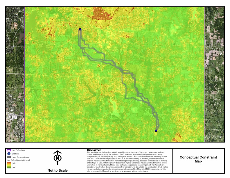
    An application to create conceptual feasibility maps for various types of energy projects
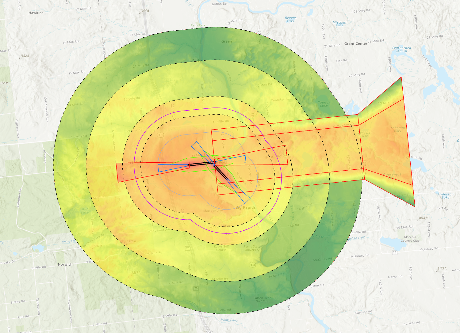
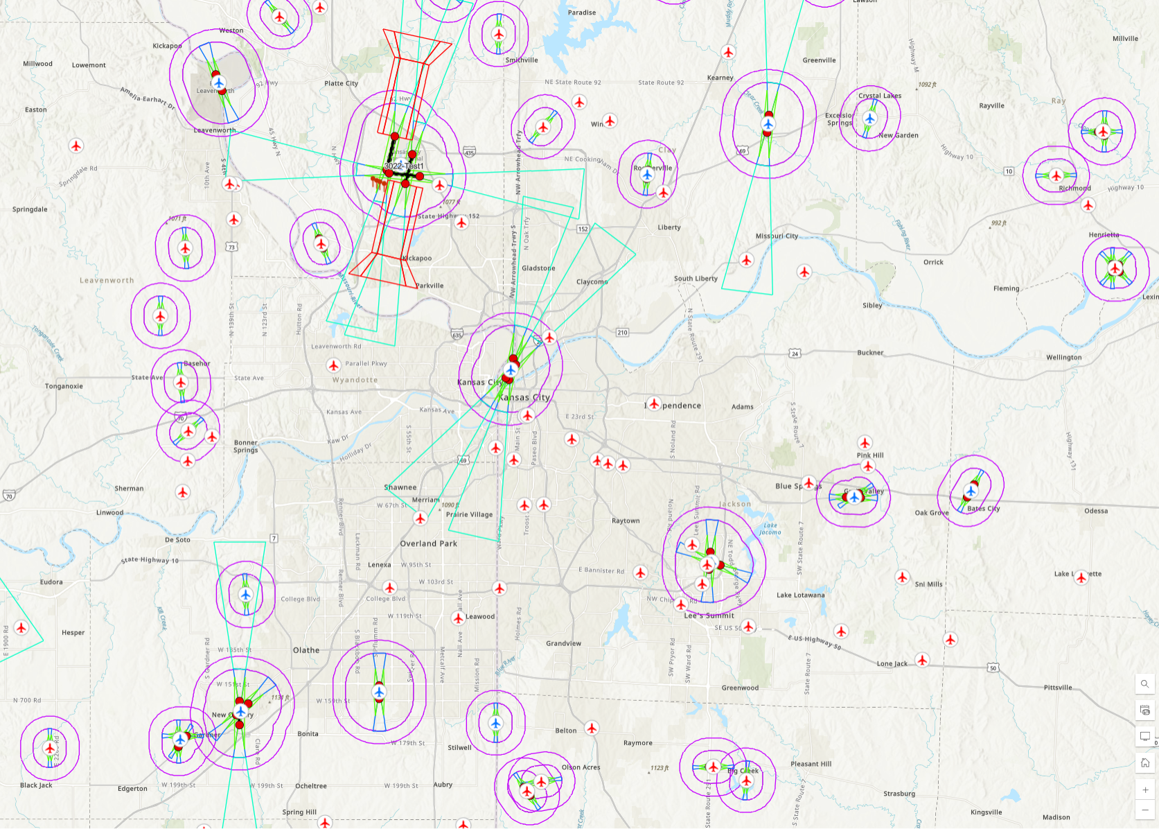
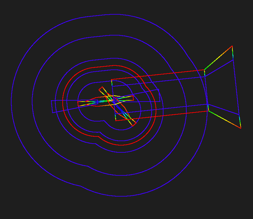
    Geospatial Governance Program
    ArcGIS

    Geospatial Governance Program

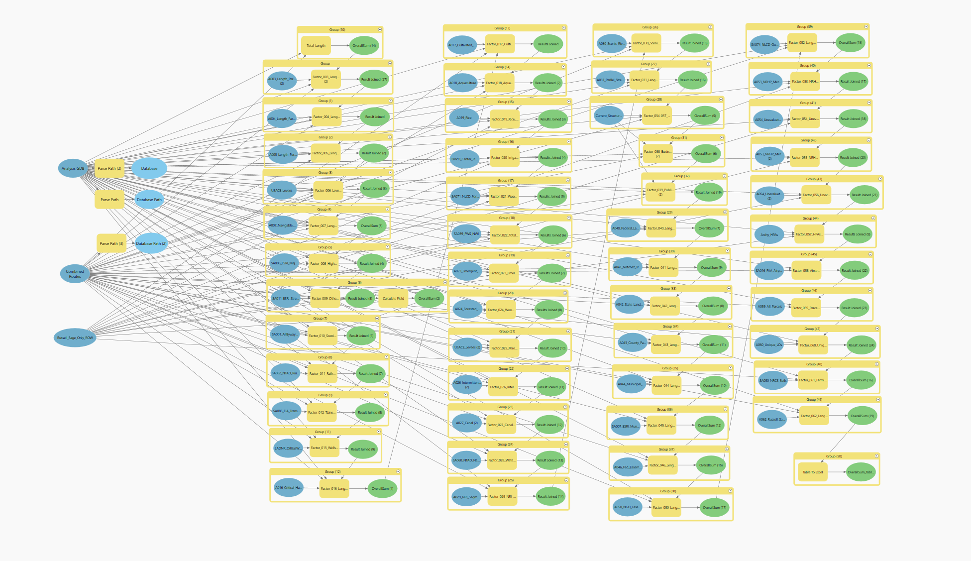
    Revolutionizing Geospatial Management: Streamlining Processes, Enhancing Quality, and Saving Thousands of Hours Annually.